Using the Internet to Scout a Location
One of the key aspects of successful landscape photography is preparation and planning. Even for those photographers who like ‘mindful’ photography still choose where and when to go somewhere. In ‘olden times’, planning meant an Ordnance Survey map and a sun compass, which was obviously good enough for a whole legion of landscape photographers but the Internet now provides us some stunning new tools to plan a photography trip.
In order to illustrate how we can use these new tools, I’ll use my up coming trip to Eigg as an example of how I use these tools..
General Overview
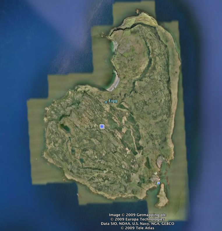
The first thing I did was to take a general look around using Google Earth. This first shot is just an overhead view, the same as you would get using Google Earth so no big shakes yet.
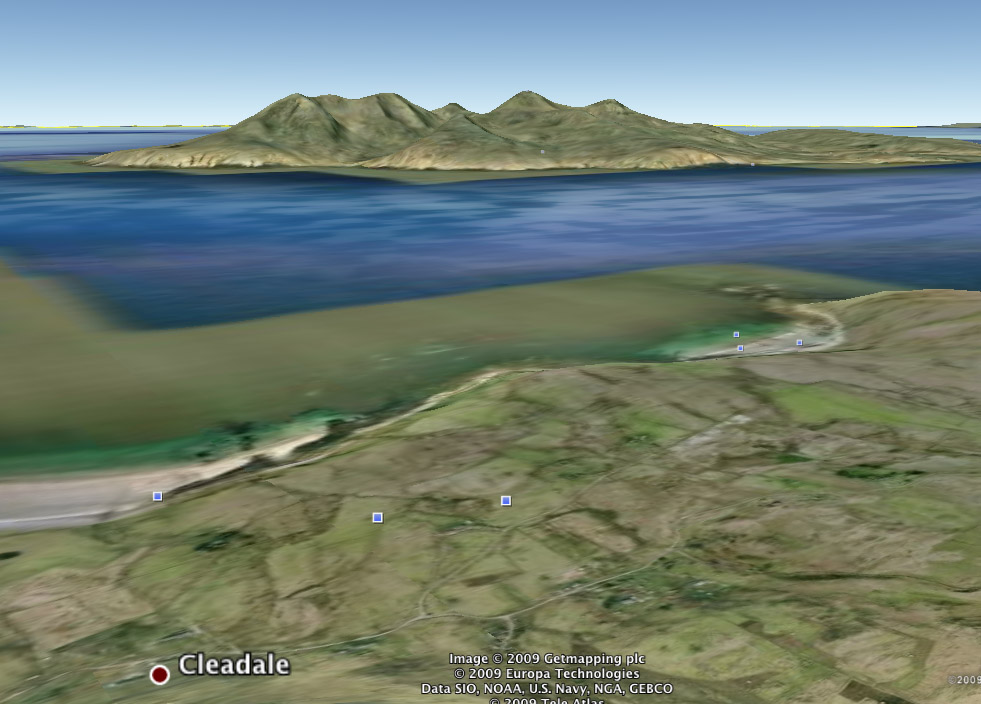
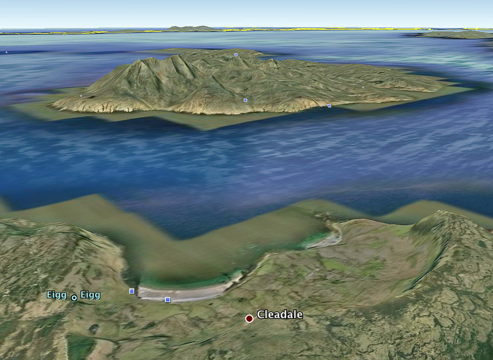
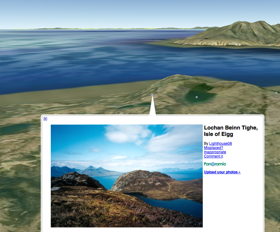
The next is a 3D shot showing the way you can position your point of view. Here I’ve gone for the ‘standard’ Eigg Laig shot with a slightly higher angle as a bonus.
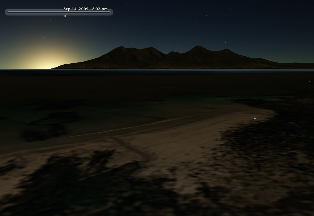
The next shot gets a little more interesting. Google Earth has had sun simulation for some time but it’s only recently had the ability to change the date so you can see where the sun will set and also, more interestingly, where your twighlight glow will be..
Another program that does the sunrise/sunset thing (but has a lot more features) is the Photographer’s Ephemeris by Stephen Trainor. This is a stunning little peice of software is simple to use and gives you nearly all the information you need.
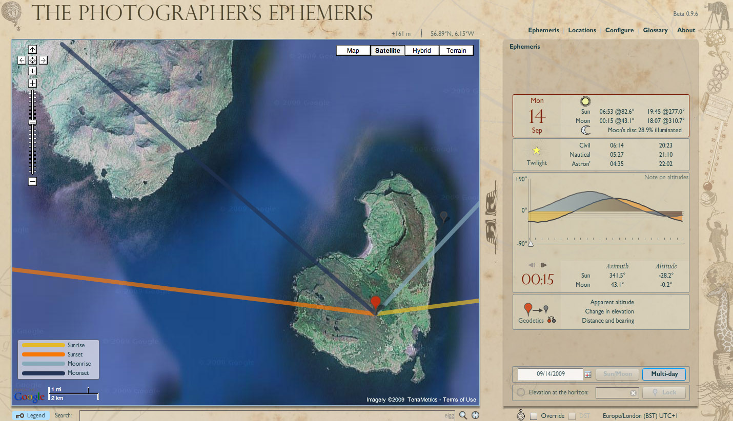
As a quick aside about this program, click here checkout this blog post from Stephen explaining how you can use his program to calculate the relative angles between different locations to see just when the sun will crest that mountain. This is not straightforward to do but is invaluable when planning a particular shot or ensuring you are up the mountain at the right time. I’ve just used it to find out that the Sun will scan over the tips of the mountains in Fairy Pools, Skye starting at 9.30am (where actual sunrise is 7am). Anyway – on with the story..
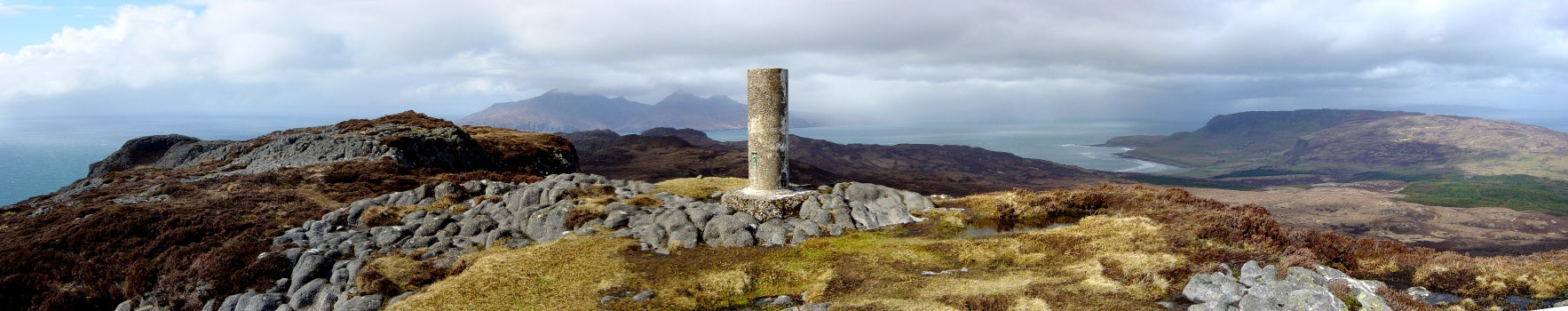
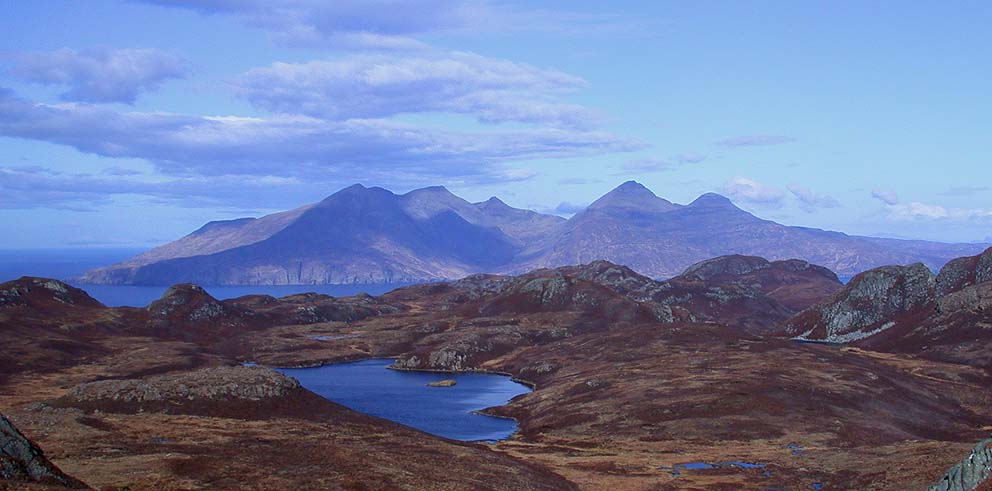
However, as I was looking around the island using Google Earth, I noticed some interesting looking lochans near the Sgurr and Google Earth shows lots of shots from Panoramio (Google’s version of Flickr).
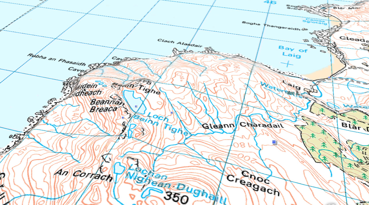
I took at look at the 1:50,000 overlay map overlay (available from Gavin Brock’s website and not officially licensed for Google Earth but it works unofficially very well indeed.
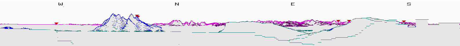
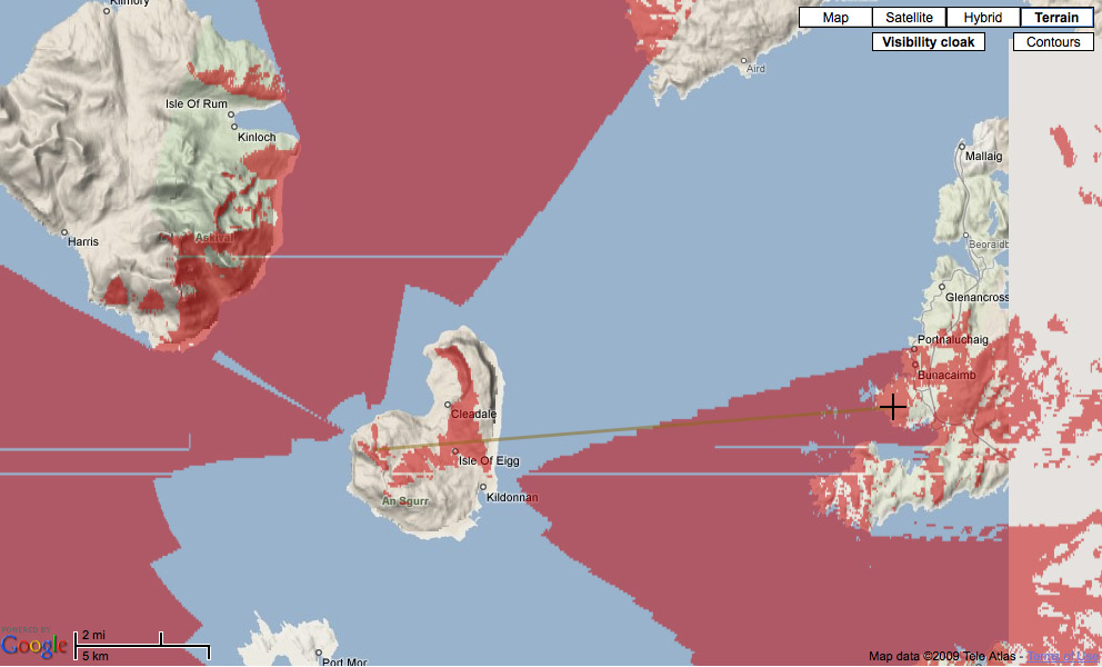
So this looks like somewhere nice to camp out overnight so I tried out another useful tool called ‘Hey What’s That?’ which can show you the view on the horizon from any point. I set it up to look at the view from the lochan I was interested in. This clearly shows Rum and the other small islands as well as the fact we can see the far mountains on the horizon. The ‘cloaking’ view shows in red the areas where you can see from the top of the island.
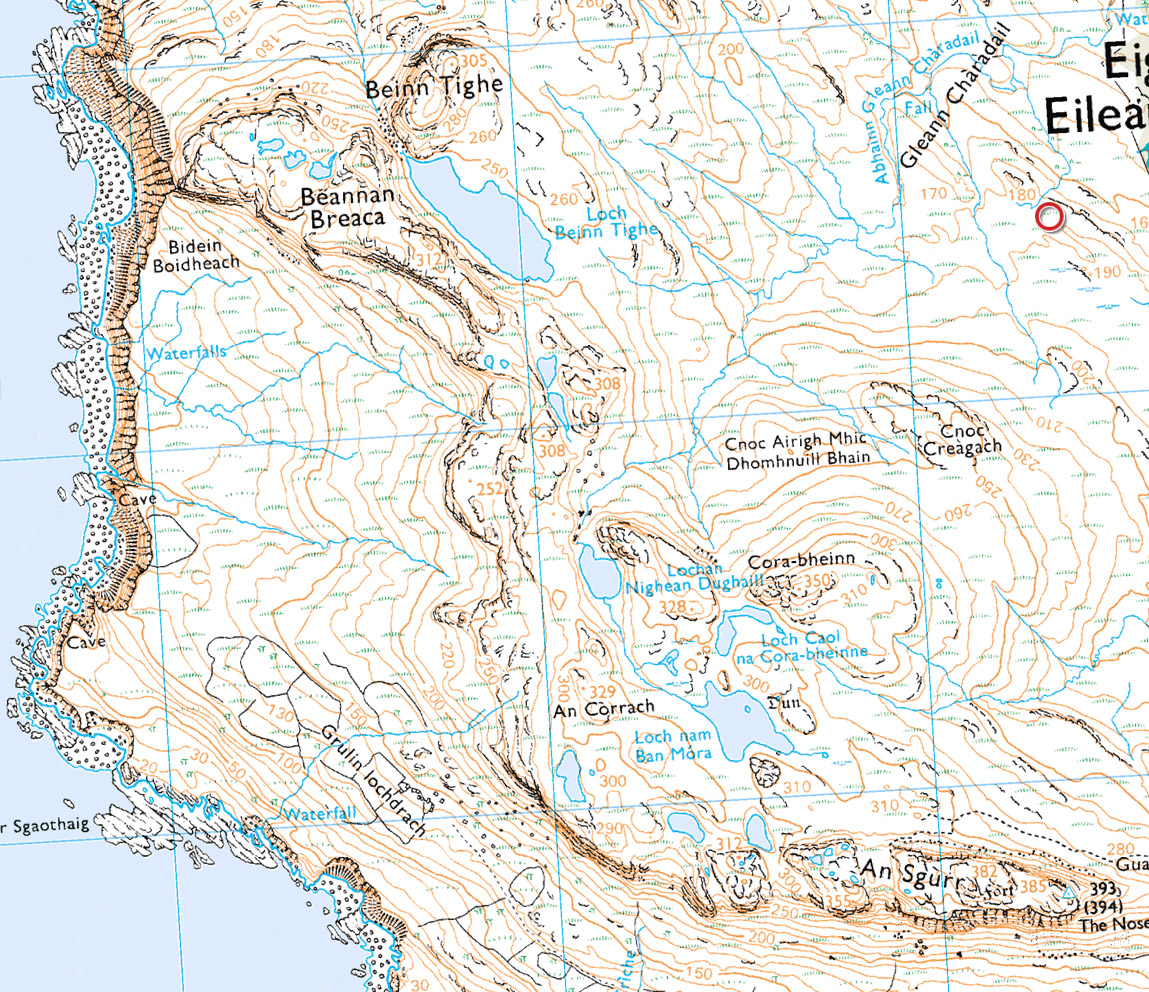
I can take a more detailed look at the area with Multimap’s new OS button that gives you interactive access to the OS Explorer 1:25,000 maps.
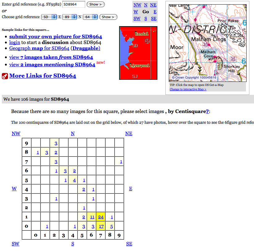
One extra tool that I use to take a wander around an area is called Geograph. It’s an open source attempt to get a photograph for every square kilometer of the UK. However, it’s already managed most kilometer squares and in some places is going past that to 100m squares. Here is a sample area covering Goredale Scar in the Yorkshire Dales.
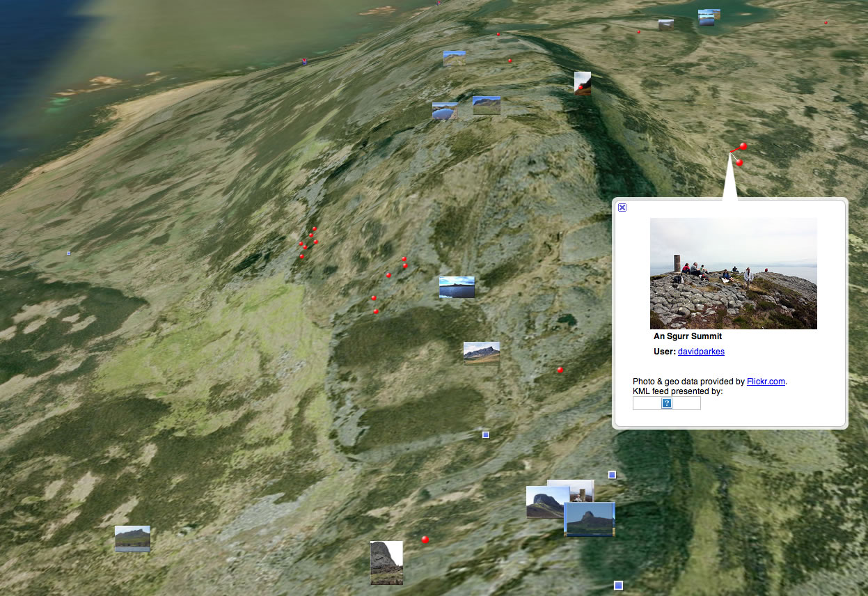
Which you can plugin into Google Earth by downloading the KML file (just click on the KML link of the Geograph home page). I’ve also added flickr images to this Google Earth view around the Sgurr of Eigg. The red dots are flickr pictures, the tiny thumbnails are geograph pictures, the blue dots are panoramio pictures/
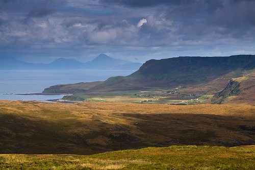
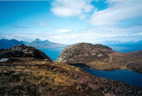
Finally, with the proviso that some people may not like this bit, I like to use Flickr, Alamy, Corbis and Google image search to browse around items of interest around a target location. This gives me an idea of potential features, geography, etc. I stress that I don’t use this to plagiarise compositions although I won’t avoid a shot whilst I’m on location because I’m reminded of one I saw previously.
These are some of the results for the area around the peak I’m interested in on Eigg.
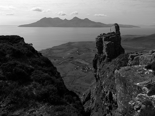
by Sue White
This is just a quick overview of the tools I’m using to plan trips out, if you want to ask any questions or have any additional online tools you find useful, let me know and I’ll expand on this article a bit..
Don’t forget though, there is nothing more important than legwork once you are out there. I’m hoping to camp in the hollow near the small lochan at the north end of the ridge, having taken some sunset shots and in preparation for some dawn glow around the geological features that surround the area.
If anybody has been up to this ridge, I’d love to know your experiences and any tips!
ADDENDUM: More pictures in another blog post
20 Responses to “Using the Internet to Scout a Location”